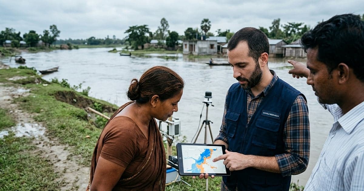
More than 150 countries and 2 billion people now receive AI-powered flood forecasts via the Google Flood Hub, according to Google Research. The system posts riverine forecasts up to seven days ahead and urban flash flood outlooks up to 24 hours before impact, with maps refreshed daily and shared at no cost.
What Google Flood Hub delivers today
Google says its models generate real-time flood maps, water trends, and risk levels that governments, aid groups, and at-risk communities can use to plan evacuations or deploy resources. The public-facing Flood Hub site aggregates those outputs by location, letting users check expected river heights, view forecast windows, and share updates across social channels.
According to Google Research, the project includes an API for researchers and agencies and an open-sourced hydrology model to support local adaptation and scrutiny. The company situates this work within its broader Earth models and datasets for planetary intelligence, described as part of its Google Earth AI effort. The core promise is reach: daily, machine-generated guidance for countries that often lack dense gauge networks or consistent warning services.
Why these AI flood forecasts matter
Floods kill thousands of people every year and displace millions. Early warnings save lives when they are trusted, timely, and specific. The World Meteorological Organization has long pushed for broader coverage and quality, but many regions still fall short. If models can extend reliable alerts into underserved areas, they shift the baseline for preparedness.
Here, scale and openness are the story. Google Research reports that its coverage spans more than 150 countries and targets 2 billion people, with forecasts that update daily and are free to access. That footprint puts the system among the few AI solutions operating at continental and cross-continental scope, not just in pilots. The public portal lowers the barrier for community groups that lack technical staff, while the API invites expert review and integration into local alerting channels.
There is another signal in the design: two different horizons for two different problems. Riverine floods usually unfold over days, so seven-day prediction windows can inform staged responses. Urban flash floods develop fast and hit hard, so the 24-hour window balances lead time with the short memory of convective storms. Those choices reflect operational constraints, not marketing claims.
How the models work and where they fall short
Google describes a pipeline that fuses hydrologic modeling with machine learning and global data sources. That includes runoff and reforecast products, terrain data, and observations needed to estimate water movement across basins. By open-sourcing a hydrology model component and offering an API, the team allows specialists to validate assumptions, tune parameters, and test transferability across climates.
Limits remain. Flash flood prediction still depends on high-resolution rainfall estimates, detailed urban drainage maps, and local calibration that is hard to standardize. River gauges are sparse in many basins, which complicates verification. False alarms erode trust; missed events do worse. Google acknowledges these realities by separating riverine and urban forecasts, updating daily, and focusing on visualization meant to support, not replace, official warnings.
Public access also surfaces a policy question: how to align a global platform with national authorities. Many countries set thresholds and wording for alerts through meteorological and disaster agencies. A public portal that shows risk before an official bulletin can confuse people on the ground. That’s why interoperability, audits, and clear disclaimers matter as much as accuracy. Agencies that choose to integrate outputs through the API can tailor messages to their protocols, a path groups like the UN Office for Disaster Risk Reduction endorse for early warning systems.
Where Google Flood Hub fits in the response chain
Forecasts are only useful when they drive action. The Google Flood Hub addresses awareness: it shows who might be hit, when, and by how much. That can trigger pre-positioning by emergency managers, targeted outreach by NGOs, and household decisions like moving vehicles or livestock.
The API and open hydrology model extend the impact upstream. Researchers can compare events, study biases, and plug the data into local tools. Agencies can feed the outputs into SMS systems, sirens, or radio scripts already trusted by residents. Because the maps and forecasts are free, smaller municipalities can test them without procurement hurdles.
The upside grows when partners stitch forecasts to action protocols. In many places, thresholds for evacuation or school closures hinge on river stage or rainfall rates. If forecast skill holds at commonly used decision points, the cost of acting early falls. If it doesn’t, adjustments follow. That feedback loop is the real measure of an AI solution at scale.
What’s next for this AI solution
Three moves would push the work further. First, tighter links to national alerting channels, so model guidance and official bulletins stay in sync. Second, better visibility into model performance by basin and season, so planners can judge fit-for-purpose quickly. Third, language and accessibility improvements for low-bandwidth regions, where even a fast map can be out of reach.
On Google’s side, the research team already signals continued expansion in coverage and capabilities. According to Google Research, the models now sit within a broader Earth AI collection, which suggests more datasets to cross-check and more chances to adapt to local conditions. Deeper collaboration with hydrologists and disaster agencies could convert forecast skill into faster, fairer warning reach.
The test for the Google Flood Hub is simple: do more people get timely, trusted warnings, and does loss go down? If yes, this is what mature, public-interest AI looks like—less headline heat, more steady service. For more on this, see ai.google.